Paul’s Journeys in Acts
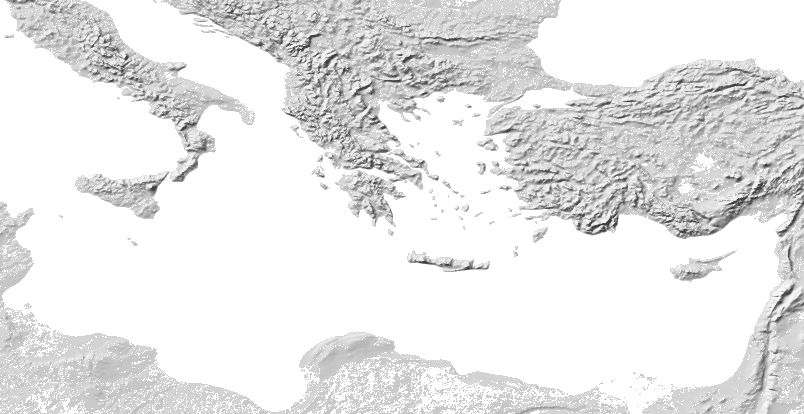
Acts records Paul’s travels as a sequence of places. This map draws two of those sequences on modern terrain: the journey from Troas through Macedonia to Athens, and the voyage from Caesarea to Rome. A road line is evidence from the Itiner-e dataset, and a dashed piece is a segment that dataset marks conjectured. A wide band is an illustration between places Acts names. It is not a known sailing track. Where Acts does not describe the track, the map leaves a gap.
The order is the order in Acts, not a calendar. The book does not date these stops. Relief and coasts are Natural Earth, a modern base in the public domain. They are not a reconstruction of a first-century shoreline, and the map draws no country borders. The first journey in Acts 13–14, and the later travel through Ephesus, are not on this map.
Read the chapters on Acts. The “we” in Acts 16:10 and Acts 27 is not named there. Who Wrote Matthew, Mark, and Luke? records the later identification of Luke as Paul’s companion. Did Paul Invent Christianity? is a separate article about that claim. The Timeline and the Connections map are the other visual tools.
- Road piece Itiner-e marks certain. This is the road dataset, not Acts.
- Road piece Itiner-e marks conjectured. Most pieces on this map are this.
- Illustrative band. Not a known sailing track.
- Alternative identification, drawn with the selected stop.
- No line. Acts does not describe the track.
Macedonia and Athens
Acts 16:11–17:15
Acts 16:11–17:15 follows Paul from Troas to Athens. Silas and Timothy are already with him from Lystra (Acts 16:1–3). At Troas the narrative changes to “we” (Acts 16:10). Acts does not name that narrator. The road line uses the Roman network between the cities Acts names, including stretches that pass places the chapter does not mention.
-
Acts 16:8–11. Acts 16:8 says they came down to Troas. That night Paul sees a man of Macedonia asking for help, and the party sails.
No path. This is the first stop on this map. The earlier walk through Phrygia, Galatia, and Mysia is not drawn.
Pleiades 550434, Antigoneia/(Col. Augusta) Alexandria Troas. The gazetteer marks this representative point precise.
- Acts 16:9, Paul
- Acts 16:19, Silas
- Acts 16:1, Timothy
-
Acts 16:11. Acts 16:11 says they came with a straight course to Samothrace, and the next day to Neapolis. The verse names the island. It does not say they went ashore.
Illustrative band. Not a known track. The wide band joins Troas and Samothrace because the verse calls the course straight. It is an illustration of that sentence. It is not a logged bearing, and it is not a road.
Pleiades 501596, Samothrace (settlement). The gazetteer marks this representative point precise.
-
Acts 16:11. Neapolis is the port Acts names the day after Samothrace. The point is the Thracian port, Pleiades Neapolis (Kavalla), not the city in Italy.
Illustrative band. Not a known track. The wide band continues the straight course of Acts 16:11 from Samothrace to that port. It is an illustration of the places the verse names. The track of the ship is not recorded.
Pleiades 501523, Neapolis (Kavalla). The gazetteer marks this representative point precise.
-
Acts 16:12. From Neapolis they go to Philippi, called a chief city of that part of Macedonia and a colony. Lydia hears Paul by the river, and Paul and Silas are imprisoned.
Road evidence, not the list in Acts. Itiner-e has a short conjectured road between the port and the city. Acts names both places and does not describe the road. The line is that reconstruction, not a surveyed footpath.
Pleiades 501482, Krenides/Philippi/Col. Augusta Iulia Philippensis. The gazetteer marks this representative point precise.
- Acts 16:14, Lydia
- Acts 16:27, The jailer
-
Acts 17:1. Acts 17:1 says they passed through Amphipolis and Apollonia and came to Thessalonica. It does not describe a stay.
Road evidence, not the list in Acts. The line is the shortest path on the Itiner-e network between Philippi and Amphipolis. Those segments are marked conjectured. The road can bend with the terrain. It is not a claim that Paul walked one paving line.
Pleiades 501347, Amphipolis. The gazetteer marks this representative point precise.
-
Acts 17:1. Apollonia is the second city Acts says they passed through. The point is the Via Egnatia station in Mygdonia, between Amphipolis and Thessalonica, not Apollonia in Illyria.
Road evidence, not the list in Acts. Strabo describes the Egnatian Road as a measured Roman road as far as Thessalonica. Pleiades identifies this Apollonia as the station on that road between Amphipolis and Thessalonica. The line follows the conjectured Itiner-e segments between those points.
Pleiades 491526, Apollonia. The gazetteer marks this representative point precise.
-
Acts 17:1. They come to Thessalonica, where there is a synagogue. Jason receives them. After three sabbaths, the city is in an uproar and the brethren send Paul and Silas away by night.
Road evidence, not the list in Acts. One Itiner-e segment is named Thessalonike–Apollonia and is conjectured. The drawn line can also use neighboring segments, so it is a corridor, not a single inscription.
Pleiades 491741, Thessalonica. The gazetteer marks this representative point precise.
- Acts 17:5, Jason
-
Acts 17:10. The brethren send Paul and Silas to Berea. The people search the scriptures. Acts 17:14 then sends Paul away to the sea, while Silas and Timothy remain.
Road evidence, not the list in Acts. The Itiner-e path from Thessalonica to Berea runs by Pella. Some of those segments are marked certain and some conjectured. Acts does not name Pella. The line is a Roman-road corridor, not the chapter’s own list of towns.
Pleiades 491546, Ber(r)oia. The gazetteer marks this representative point precise.
- Acts 17:14, Silas and Timothy
-
Acts 17:15. Those who conduct Paul bring him to Athens. He speaks on the Areopagus. Dionysius and Damaris believe. Acts 17:14–15 does not name the port where he boarded.
No path. No line is drawn from Berea to Athens. The port is not named, and a modern sailing or driving route would not be evidence. Pleiades marks the Athens point as related, a representative point for the city, not a surveyed corner of the Areopagus.
Pleiades 579885, Athenae. The gazetteer marks this representative point related.
- Acts 17:34, Dionysius
- Acts 17:34, Damaris
The Voyage to Rome
Acts 27:1–28:16
Acts 27–28 takes Paul from Caesarea to Rome under the centurion Julius. Aristarchus of Thessalonica is named on the ship, and the narrative is again in the first person plural. The order below is the order of the chapter. Acts gives no calendar year for the sailing. Where the ship is driven, or the course is not described, the map leaves a gap.
-
Acts 27:1. Paul and other prisoners are delivered to Julius, a centurion of Augustus’ band. They sail from the coast of Caesarea on a ship of Adramyttium.
No path. This is the first stop of the voyage. The point is Pleiades Straton’s Tower / Caesarea, on the coast, a precise representative point.
Pleiades 678401, Stratonos Pyrgos/Caesarea. The gazetteer marks this representative point precise.
-
Acts 27:3. The next day they touch at Sidon. Julius lets Paul go to his friends.
Illustrative band. Not a known track. The wide band follows the modern shore between the two ports, because the voyage is one day along that coast. It illustrates the places Acts names. It is not a logged course, and it does not claim a distance offshore. The ancient shore was not identical to this one.
Pleiades 678393, Sidon/Col. Aurelia Pia. The gazetteer marks this representative point precise.
-
Acts 27:4. They sail under Cyprus because the winds are contrary. Acts does not name a harbor on the island.
Illustrative band. Not a known track. Jamieson, Fausset, and Brown read the wind as from the westward, with a touch of the north, and the lee as the channel between Cyprus and the mainland of Phoenicia, with the island on the left. McGarvey reads the same passage to the east and north-east, around the north-east point, again with the island on the left. The wide band joins Sidon to that modern east shore and follows it from the southeast cape to the northeast tip. It is an illustration, not a logged course, and it is not on the Peutinger table.
-
Acts 27:5. They sail over the sea of Cilicia and Pamphylia and come to Myra of Lycia. There Julius moves the prisoners to a ship of Alexandria sailing into Italy.
Illustrative band. Not a known track. The wide band follows the modern south coast of those regions, from the Gulf of Issus to Myra. Acts names the seas, not the inlets. The band is an illustration, not a logged course. Issus itself is not a stop.
Pleiades 639005, Myra. The gazetteer marks this representative point precise.
-
Acts 27:7. For many days they scarcely come over against Cnidus. The wind does not allow them to hold the course they wanted.
Illustrative band. Not a known track. The point is Pleiades Cnidus at Tekir, the tip of the peninsula a westbound ship would come against. Pleiades also records an earlier site at Burgaz. The wide band follows the modern Lycian coast. It is an illustration, not a claim they entered each bay, and not a logged course.
Pleiades 599575, Cnidus (Tekir). The gazetteer marks this representative point precise.
-
Acts 27:7. They sail under Crete, over against Salmone. The point is the northeast promontory of Crete, Pleiades Sam(m)onion, modern Cape Sideros.
No path. No line is drawn from Cnidus to Salmone. Acts does not describe that crossing. The next line begins on the Cretan shore.
Pleiades 590037, Sam(m)onion (promontory). The gazetteer marks this representative point precise.
-
Acts 27:8. They come to Fair Havens, near the city of Lasea. Paul warns that the voyage will end with hurt and damage. The harbor is not commodious to winter in. They hope to reach Phoenix and never do.
Illustrative band. Not a known track. Pleiades places Kaloi Limenes on the south coast. Its gazetteer description puts the bay about two kilometers west of Lasaia, which matches the verse. The wide band follows that modern south coast from Salmone. It is an illustration, not a logged course. Phoenix has two Pleiades sites. Neither is drawn, because the ship did not arrive there.
Pleiades 589834, Kaloi Limenes. The gazetteer marks this representative point precise.
-
Acts 27:16. A tempestuous wind, Euroclydon, catches the ship. They cannot bear up, and they let her drive. They run under an island called Clauda. The King James name is Clauda. Pleiades records the island as Kaudos.
Illustrative band. Not a known track. Acts 27:13 says they sailed close by Crete before the storm took them. The wide band follows that modern south coast and then joins Clauda. It is an illustration, not a logged course. After the island, the ship is driven. The track is not continued.
Pleiades 589858, Kaudos (island). The gazetteer marks this representative point precise.
-
Acts 28:1. They fall on an island called Melita. The islanders show kindness. Publius, the chief man, lodges them. They stay three months.
No path. No path is drawn from Clauda. Acts 27:17–44 names no position: they fear the quicksands, see neither sun nor stars, and then sight land. The filled point is the town on Malta, the identification used for the rest of this drawing. The open gold point is Pleiades Melite in the Adriatic, modern Mljet, drawn because the name Melita has also been read that way. It is not the landing used here. The Malta point is marked related, not a surveyed beach.
Pleiades 462310, Melita. The gazetteer marks this representative point related.
Pleiades 197376, Melite (island). Alternative: Mljet. Not the landing drawn here. The map shows this point only while Melita is selected.
- Acts 28:7, Publius
-
Acts 28:12. After three months they sail on a ship of Alexandria that had wintered in the island, whose sign is Castor and Pollux. They land at Syracuse and stay three days.
No path. No line is drawn from Melita to Syracuse. Acts names the two ports and does not describe the course.
Pleiades 462503, Syracusae/Syrakousai. The gazetteer marks this representative point related.
-
Acts 28:13. From Syracuse they fetch a compass and come to Rhegium.
Illustrative band. Not a known track. “Fetch a compass” means they went around. The wide band follows the modern east shore of Sicily and the strait, because these two identifications leave a ship no other way through. It is an illustration, not a single bearing and not a log.
Pleiades 452416, Rhegion/Regium. The gazetteer marks this representative point precise.
-
Acts 28:13. After one day the south wind blows, and they come the next day to Puteoli. They find brethren and stay seven days.
Illustrative band. Not a known track. The wide band follows the modern Italian shore from Rhegium around the toe and north to Puteoli. Acts gives the wind and the next day, not the headlands. It is an illustration, not a logged course. The ancient shore was not identical.
Pleiades 432815, Dikaiarcheia/Puteoli. The gazetteer marks this representative point precise.
-
Acts 28:15. Brethren from Rome meet the party at Appii Forum and at The Three Taverns. Paul thanks God.
Road evidence, not the list in Acts. The line follows Itiner-e roads from Puteoli through Capua and on toward the Via Appia. Acts does not name Capua. The segments are marked conjectured. This is a Roman-road corridor, not a list of Paul’s nights.
Pleiades 422927, Forum Appii . The gazetteer marks this representative point precise.
- Acts 28:15, Brethren from Rome
-
Acts 28:15. Acts names The Three Taverns with Appii Forum as the places where the brethren meet them.
Road evidence, not the list in Acts. Pleiades places Tres Tabernae where the Via Appia crosses the Via Ninfina. The short line is the conjectured road between that station and Appii Forum.
Pleiades 423106, Tres Tabernae. The gazetteer marks this representative point precise.
-
Acts 28:16. When they come to Rome, the centurion delivers the prisoners to the captain of the guard. Paul dwells by himself with a soldier.
Road evidence, not the list in Acts. The line is the Itiner-e approach from The Three Taverns into the city, including segments catalogued under the Appian road. Some are certain and some conjectured. Pleiades marks the Rome point as related, a representative point for the city, not the house where Paul lodged.
Pleiades 423025, Roma. The gazetteer marks this representative point related.
- Acts 28:16, The soldier
How to Read the Routes
A Roman road on this map is the shortest path, on the Itiner-e network, between the two Pleiades points. Each drawn piece keeps the certainty that dataset gave the segment. A solid piece is one it marks certain. A dashed piece is one it marks conjectured. Most of the pieces on this map are conjectured. That mark is about the road. It is not a statement that Acts names the towns the road passes. The path from Thessalonica to Berea uses segments by Pella. The path from Puteoli uses segments by Capua. Acts does not name Pella or Capua.
A sea band follows the modern shore, or joins two places when the verse calls the course straight. The band is wide so it does not read as a measured lane. It is an illustration of the places Acts names. It is not a logged course, and it does not claim a distance offshore. The first-century shore was not this shore. The storm after Clauda, the sail from Melita to Syracuse, and the crossing from Cnidus to Salmone have no band.
Acts 16:11 names a straight course, by Samothrace to Neapolis. Those two bands join the named places. They are not a claim about the wind’s bearing. When Melita is selected, the map marks both the town on Malta and Mljet in the Adriatic. No path is drawn to either one from Clauda.
Reference Maps
These are the sheets that were opened, and only the sheets that show a region this voyage crosses. None of them was traced. A nineteenth-century Bible atlas was not used. A Public Domain Mark, or a note that a library knows of no restrictions, is the statement on that scan. It is not a promise that every country’s law treats the photograph as public domain.
| Reference | Date | What Was Opened | Rights | Limitation |
|---|---|---|---|---|
| Tabula Peutingeriana, segment 07. Photograph. Manuscript: Austrian National Library, Cod. 324. | Medieval copy. The file page dates it to the 12th century. Konrad Peutinger, who later owned it, died in 1547. He did not draw it. | The Rome segment. The city is a medallion. Roads are red schematic lines with distance numbers, not a coastline. | Wikimedia calls the photograph a faithful reproduction of a two-dimensional public-domain work and free of known restrictions. That is the Foundation’s position for the United States. Other countries may still restrict the photograph. The source named on the file is the Austrian National Library. | Schematic itinerary. Not a geographic base, and not Paul’s path. Not traced. |
| Tabula Peutingeriana, segment 09. Photograph. | The same manuscript. | The Campania segment: schematic roads through the country between the Bay of Naples and Rome. | The same Wikimedia statement as segment 07. The file page cites the Austrian National Library as the source. | It does not list the stops in Acts 28. It is not a survey, and it is not traced. |
| Ptolemy, Cosmographia, Ulm. Sicily and southern Italy. | Printed by Lienhart Holle at Ulm in 1482, from the edition of Nicolaus Germanus. The coordinates come from the second century. | A woodcut opening of Sicily and the south of Italy, with Mare Africum, on the Boston Public Library scan at the Internet Archive. | The Archive records a Public Domain Mark 1.0 on item cosmographia00ptol. That mark says no copyright is known. It is the library’s label on this scan. | A Renaissance woodcut on a trapezoidal grid. Distorted. Not a sailing chart, and not the geometry of this map. |
| Ptolemy, Cosmographia, Ulm. Macedonia and the Aegean. | The same 1482 printing. | A woodcut labeled Macedonia, Epirus, Achaea, and Mare Egeum. | The same Public Domain Mark on the same scan. | The same kind of woodcut. It pictures the region of the Macedonian journey. It is not a route, and it is not traced. |
| Madaba mosaic. Library of Congress, matpc.09320. | The floor mosaic is sixth century. The photograph is from the Matson collection, between 1898 and 1946. | A photograph of the floor in the Church of Saint George at Madaba. The negative is damaged. | The catalog’s rights advisory is “No known restrictions on publication.” That sentence is not a public-domain grant. This page does not treat the photograph as public domain. | The mosaic is centuries after Acts and does not record the voyage in Acts 27. The photograph is not an ancient artifact. Neither is traced. |
Sources
- Acts of the Apostles, 16:11–17:15; 27:1–28:16. King James Version
- Pleiades Gazetteer of Ancient Places, Representative points (Creative Commons Attribution 3.0. Each plotted stop uses one published representative point.)
- Itiner-e: A High-Resolution Dataset of Roads of the Roman Empire, Static version 2024 (de Soto, Pažout, Brughmans, Vahlstrup, and collaborators, 2025. CC BY 4.0. This page reprojects, clips, and simplifies a subset.) Method note
- Natural Earth, 1:50m shaded relief and 1:10m land (Public domain. Modern relief and coasts, not a first-century shoreline.)
- Strabo, Geography, 7.7.4 (The Egnatian Road measured to Thessalonica. Jones translation, 1924, on Perseus.)
- Tabula Peutingeriana, Austrian National Library, Cod. 324 (Medieval copy. The Commons file page dates it to the 12th century. Schematic, not a geographic base for these lines.) Rome segment Campania segment
- Madaba Map Mosaic, Church of Saint George, Madaba (A sixth-century mosaic. The Library of Congress rights advisory on the Matson photograph is “No known restrictions on publication.” That is not a public-domain grant.)
- Ptolemy, Cosmographia, Ulm: Lienhart Holle, 1482 (Renaissance woodcuts of second-century coordinates. The Internet Archive records a Public Domain Mark 1.0 on this Boston Public Library scan. Not the base of these lines.) Sicily and southern Italy Macedonia and the Aegean
- Jamieson, Fausset, and Brown, Commentary, Acts 27:4 (Nineteenth-century reading of the lee of Cyprus. Not an ancient map.)
- J. W. McGarvey, Original Commentary on Acts, Chapter 27 (Nineteenth-century reading of the same lee shore. Not an ancient map.)